
The use of drones for both for local governmental and environmental activities was explored considerably in 2018, with a major PwC report revealing that the total global market for drone powered business operations is valued at almost €150 billion.
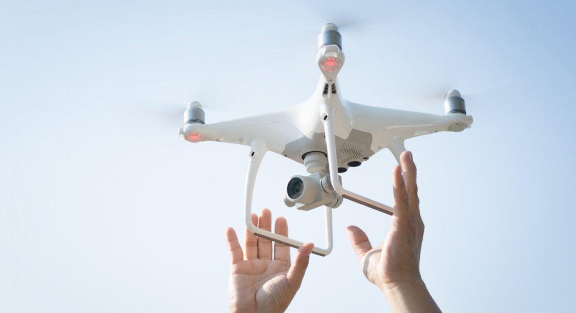
Drones, or UAV’s (Unmanned Aerial Vehicle) are already widely used by surveyors, engineers, emergency services, construction firms, agricultural workers and those in many other sectors. Survey mapping in particular is a major consideration for local authorities who could use drones for environmental monitoring. Last year, Clare County Council trialled the use of drone technology for automated beach patrols for the first time here, while several bodies involved in search and rescue operations use drones to locate the remains of missing persons.
Major energy and engineering firms such as the ESB used drones to monitor faults and power line safety, and this principle is easily transferable to almost any other area of industry. One of the issues relating to UAV’s is certification and the Irish Aviation Authority have introduced a licensing process for certain types of drone activity.
PwC Ireland’s Advisory Leader, Ciarán Kelly, said: “Drones and the data they provide are a game changer over the entire lifecycle of a transport infrastructure investment. Provision of real-time, accurate and comparable 3D modelling data is crucial during the pre-construction, construction and operational phases of an investment project, and all of this data can be acquired by intelligent and cost-effective drone powered solutions.”
Drone technologies can be used at almost every stage in the transport infrastructure life sector, starting from construction and investment monitoring, through maintenance, up to asset inventory. During construction, data gained through drones can facilitate rapid reactions to any deviations from the plan, and in extreme cases might be used as evidence in litigation. For example, in one construction project supervised by Drone Powered Solutions, the investor had savings of approximately US$2.94 million in claims settlement litigation thanks to unparalleled evidence.
Other applications range from the detection and prevention of trespassing, to placement of trench protection, to enhancing site safety. For instance, the PwC Drone Powered Solutions team has calculated that the number of life threating accidents on an average construction site monitored by drones has been reduced by up to 91%.
Illegal Waste
On a state level, funding is beinb increased to use drone and surveillance technology to combat the problem of illegal dumping.
The Minister for the Environment, Denis Naughten TD, has allocated €2 million for this initiative to monitor and gather intelligence on illegal activities at dumping blackspots around the country. A similar campaign last year removed over 2.8 thousand tonnes of illegal waster from public and private lands, beaches, walking routes and residential areas.
This year’s initiative has seen the funding increase by over €700,000 and local authorities and community groups can apply for funding under the initiative.
Infrastructure
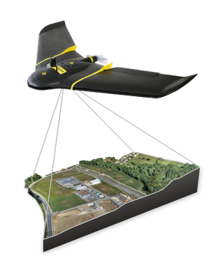
Transport Infrastructure Ireland (TII) is to pay a Dublin firm €100,000 to use drones to help survey the country’s multibillion euro motorway system, it was announced in August of this year. Dublin firm Korec has won the five-year contract and, according to spokesman for TII Sean O’Neill, the UAV (unmanned aerial vehicle) or drone technology will cover as much ground area in one flight in under an hour as a traditional ground-based survey team would cover in 14 days. “As a result multiple flights can be undertaken in one day based on requirements,” he said, talking to the Irish Times. According to Mr O’Neill, the new contract – which will involve the use of two drones – will produce cost savings for TII. TII currently oversees 1,220km of motorway and dual carriageway across the country and, up until now, when carrying out inspections, TII deploys staff in the field with the task of setting up traffic management and diverting traffic, but that will be avoided by being able to put a drone in the air. “UAVs reduce the requirement for traffic management which reduces risk to staff and the travelling public as well as cost savings from not having to do traffic management,” said Mr O’Neill. He added: “UAVs will reduce the need for procurement of aerial surveys for route designs from third parties through the use of planes.
“You typically do multiple surveys as part of the early design stage. Therefore the investment in this technology offers a significant savings in time and resources.”
The contract with Korec includes annual software licensing fees and is fixed for a term of five years.
Mr O’Neill also pointed out that the contract includes two UAVs, and the typical uses will be to perform aerial topographic surveys, corridor mapping, structural inspections and deformation monitoring.
The outputs from the work are to include Digital Surface Models (DSM), Digital Elevation Models (DEM), 3D meshes and fly-through animations.
TII has taken the decision to deploy the drone technology after its success in other jurisdictions and in industries such as agriculture and construction.
International Recognition
In other developments in the sector, it was announced in early December that Drone Consultants Ireland have won a Business Incubation package worth €62,000 in the Galileo Masters 2018 SatNav Competition at the Space Oscars in Marseille. The prize, funded by the European Commission, provides a range of tailored business, technical and product development supports over the next 12 months.
Drone Consultants Ireland are Galileo Masters Ireland Region 2018 Winners for their Jack-In-The-Box concept and so went forward to compete against the best of Europe in the finals, held during European Space Week in the grandeur of the Pharo Palace.
Jack-In-The-Box, the self-sustaining, drone system that can be aircraft-deployed into adverse or remote locations, will provide 500 hours flying endurance compared to a standard drone’s 25 minutes. It has immediate applications in search & rescue, environmental, humanitarian and disaster situations.
The tethered UAV (Unmanned Aerial Vehicle) is equipped with an optical zoom and thermal camera to survey 300sq km of terrain from a fixed position (Dublin City is 115sq km), and can live stream visual data via satellite to Emergency Control Centres or rescue teams, while simultaneously transmitting high accuracy location data of assets, people or rapidly evolving situations. It can also provide wi-fi or radio communications services to connect persons in danger.